Stage 4 Alba de Yeltes - Ciudad Rodrigo

Santiago de CompostelaPadrónCaldas de ReisPontevedraRedondelaTuiRubiãesPonte de LimaBragaGuimarãesFelgueirasAmaranteMesão FrioLamegoMoimenta da BeiraSernancelheTrancosoPinhelAlmeidaGallegos de ArgañanCiudad RodrigoAlba de YeltesSan MuñozRobliza de CojosSalamanca

Alba de Yeltes

Ciudad Rodrigo

26 Km Distance
Medium Difficulty
6 Hours Duration
674 m Ameal 7,8 km 16,4 km 7,8 km SALAMANCA 805,3 m 882,8 m (altitudemáx.) Peñasolana 867 m 826 m El Encinar de la Rad 837 m (altitudemáx.) 6,5 km 4,1 km 8,4 km 819,3 m ROBLIZA DE COJOS 810 m Ermida de Santiago 819 m Estrada CV-107 12,4 km 9,6 km 4 km 839 m (altitudemáx.) 797 m Rio Yeltes 821 m Ribeira de Cabrillas SAN MUÑOZ 778 m 844 m (altitude máx.) 10,6 km 7,1 km 8,3 km 771 m Bocacara 727 m Pedro Toro ALBA DE YELTES 784,4 m 689 m (altitudemáx.) 12,4 km 3,6 km 621,5 m CIUDAD RODRIGO 596 m Ponte de Marialba 8,3 km 12,4 km 5,3 km 758,5 m (altitude máx.) Vale da Mula 689 m Aldea del Obispo 718 m Alameda de Gordón 663,3 m GALLEGOS DE ARGAÑAN 12,6 km 5,2 km 3,5 km 540 m Ponte do Rio Côa 739 m ALMEIDA 685 m Valverde 8,8 km 6,7 km 7,4 km 7,8 km 557 m Póvoa del Rei 633,6 m PINHEL 584 m Valbom 605 m Ponte do Abade 862 m TRANCOSO 6,4 km 9,1 km 11,9 km 650 m Benvende 3,5 km 9,5 km 3,8 km 2,7 km 592 m Arcozelo do Cabo 763 m SERNANCELHE 590 m Penso 564 m Vila da Ponte 839,9 m (altitude máx.) 14,6 km 10 km 5 km 451 m Ucanha 759 m Sarzedo 696,8 m MOIMENTA DA BEIRA 9,3 km 6,3 km 5,3 km 6,9 km 387 m Nostim Peso da Régua 529,5 m LAMEGO 258 m Valdigem 883,5 m (altitude máx.) 13,2 km 6 km 8,4 km 157 m Ovelhinha 316,7 m MESÃO FRIO 779 m Padrões 412,4 m (altitude máx.) 8,5 km 7 km 5 km 336 m Caramos 264 m Telões 95,9 m AMARANTE 425,2 m (altitude máx.) 12 km 5,8 km 315,7 m FELGUEIRAS 156 m Arco de Pombeiro 8,9 km 4 km 7,8 km 236 m Fraião 128 m Caldas das Taipas 194,5 m GUIMARÃES 436,7 m (altitude máx.) Falperra Vila de Prado 17 m Penegate 127 m Anais 238 m 274,8 m (altitude máx.) 7 km 12,1 km 8,7 km 7,6 km 190,5 m BRAGA 400,4 m (altitude máx.) 10 km 6 km 2,9 km 30 m Arcozelo Alto da Labruja 2,3 m PONTE DE LIMA 230,9 m (altitude máx.) 11 km 5,7 km 6,1 km 9,7 km 18 m Cruz de São Telmo 31 m O Porriño 83 m Mós 50,8 m TUI 275,3 m (altitude máx.) 11,2 km 2,6 km 4,7 km 34 m Valença 172 m Gontomil 200,7 m RUBIÃES 128,1 m (altitude máx.) 16 km 4,9 km 30 m Briallos 10,1 m PONTEVEDRA 153,3 m (altitude máx.) 5 km 7 km 8 km 31 m O Pobo 5 m Pontesampaio 13,5 m REDONDELA 164,9 m (altitudemáx.) 6,3 km 6,7 km 5,7 km 60 m São Miguel de Valga 147 m Carracedo 24,8 m CALDAS D’EL REIS 12,7 km 5,2 km 6,2 km 40 m A Escravitude 103 m Francos 265,7 m 9,9 m PADRÓN SANTIAGO DE COMPOSTELA

Introduction

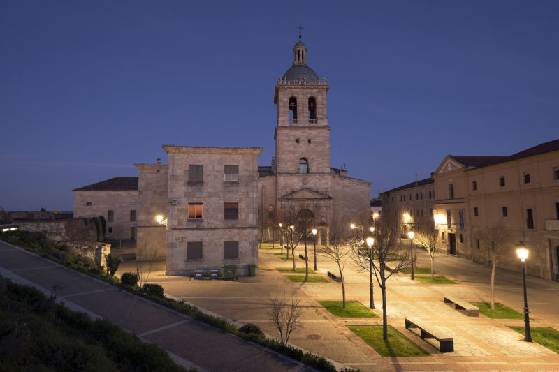
A city that can be seen from the distance at Calzada Colimbriana

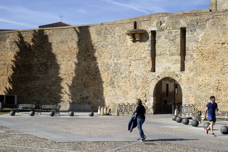
After days of isolation, it feels good to enter a city, walk through its streets, talk to its inhabitants, stop at the Plaza Mayor and enjoy the urban environment. Ciudad Rodrigo emerges from the flat, arid landscape, first as a solitary element on the horizon, then as a relevant fortification overlooking the Águeda River. Once you see the contours of its walls, you realise that you are before a city full of history, keeper of borders fought hard for over the centuries.

In the Middle Ages, the road that linked Salamanca to Ciudad Rodrigo was known as Calzada Colimbriana, because it was the easiest way to get to Coimbra (as it still is today, but along tarmac roads).

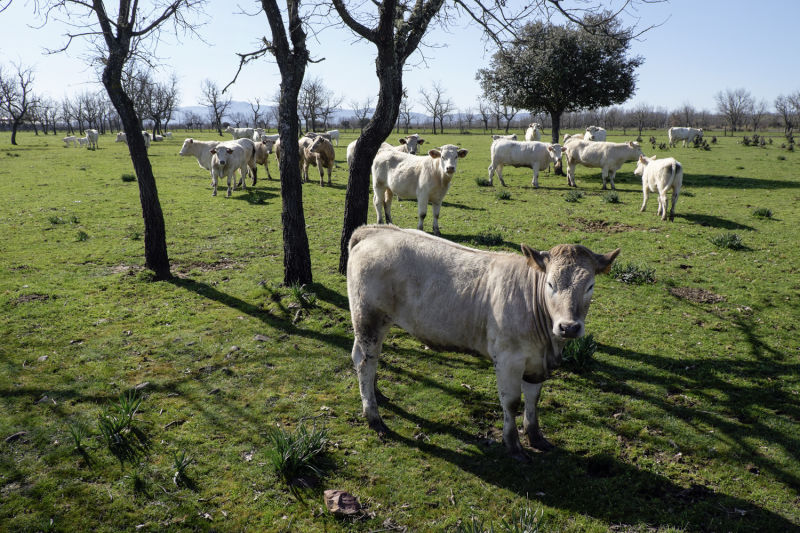
The way to Ciudad Rodrigo is difficult and lonely. You must stock up at Bocacara, as there will be no support services for more than 15 km between oak trees and arid roads surrounding the Peronilla mountain. After Pedro Toro, turn left to a dirt track leading to the Our Lady of Penha de França chapel. It is the last reference point before entering the city.

Alternative dispute resolutionPrivacy policyCookies policyTerms and conditions 2024 In case of dispute click here here.