Stage 12 Lamego - Mesão Frio

Santiago de CompostelaPadrónCaldas de ReisPontevedraRedondelaTuiRubiãesPonte de LimaBragaGuimarãesFelgueirasAmaranteMesão FrioLamegoMoimenta da BeiraSernancelheTrancosoPinhelAlmeidaGallegos de ArgañanCiudad RodrigoAlba de YeltesSan MuñozRobliza de CojosSalamanca

Lamego

Mesão Frio

27,8 Km Distance
High Difficulty
7 Hours Duration
674 m Ameal 7,8 km 16,4 km 7,8 km SALAMANCA 805,3 m 882,8 m (altitudemáx.) Peñasolana 867 m 826 m El Encinar de la Rad 837 m (altitudemáx.) 6,5 km 4,1 km 8,4 km 819,3 m ROBLIZA DE COJOS 810 m Ermida de Santiago 819 m Estrada CV-107 12,4 km 9,6 km 4 km 839 m (altitudemáx.) 797 m Rio Yeltes 821 m Ribeira de Cabrillas SAN MUÑOZ 778 m 844 m (altitude máx.) 10,6 km 7,1 km 8,3 km 771 m Bocacara 727 m Pedro Toro ALBA DE YELTES 784,4 m 689 m (altitudemáx.) 12,4 km 3,6 km 621,5 m CIUDAD RODRIGO 596 m Ponte de Marialba 8,3 km 12,4 km 5,3 km 758,5 m (altitude máx.) Vale da Mula 689 m Aldea del Obispo 718 m Alameda de Gordón 663,3 m GALLEGOS DE ARGAÑAN 12,6 km 5,2 km 3,5 km 540 m Ponte do Rio Côa 739 m ALMEIDA 685 m Valverde 8,8 km 6,7 km 7,4 km 7,8 km 557 m Póvoa del Rei 633,6 m PINHEL 584 m Valbom 605 m Ponte do Abade 862 m TRANCOSO 6,4 km 9,1 km 11,9 km 650 m Benvende 3,5 km 9,5 km 3,8 km 2,7 km 592 m Arcozelo do Cabo 763 m SERNANCELHE 590 m Penso 564 m Vila da Ponte 839,9 m (altitude máx.) 14,6 km 10 km 5 km 451 m Ucanha 759 m Sarzedo 696,8 m MOIMENTA DA BEIRA 9,3 km 6,3 km 5,3 km 6,9 km 387 m Nostim Peso da Régua 529,5 m LAMEGO 258 m Valdigem 883,5 m (altitude máx.) 13,2 km 6 km 8,4 km 157 m Ovelhinha 316,7 m MESÃO FRIO 779 m Padrões 412,4 m (altitude máx.) 8,5 km 7 km 5 km 336 m Caramos 264 m Telões 95,9 m AMARANTE 425,2 m (altitude máx.) 12 km 5,8 km 315,7 m FELGUEIRAS 156 m Arco de Pombeiro 8,9 km 4 km 7,8 km 236 m Fraião 128 m Caldas das Taipas 194,5 m GUIMARÃES 436,7 m (altitude máx.) Falperra Vila de Prado 17 m Penegate 127 m Anais 238 m 274,8 m (altitude máx.) 7 km 12,1 km 8,7 km 7,6 km 190,5 m BRAGA 400,4 m (altitude máx.) 10 km 6 km 2,9 km 30 m Arcozelo Alto da Labruja 2,3 m PONTE DE LIMA 230,9 m (altitude máx.) 11 km 5,7 km 6,1 km 9,7 km 18 m Cruz de São Telmo 31 m O Porriño 83 m Mós 50,8 m TUI 275,3 m (altitude máx.) 11,2 km 2,6 km 4,7 km 34 m Valença 172 m Gontomil 200,7 m RUBIÃES 128,1 m (altitude máx.) 16 km 4,9 km 30 m Briallos 10,1 m PONTEVEDRA 153,3 m (altitude máx.) 5 km 7 km 8 km 31 m O Pobo 5 m Pontesampaio 13,5 m REDONDELA 164,9 m (altitudemáx.) 6,3 km 6,7 km 5,7 km 60 m São Miguel de Valga 147 m Carracedo 24,8 m CALDAS D’EL REIS 12,7 km 5,2 km 6,2 km 40 m A Escravitude 103 m Francos 265,7 m 9,9 m PADRÓN SANTIAGO DE COMPOSTELA

Introduction

The great river of the North

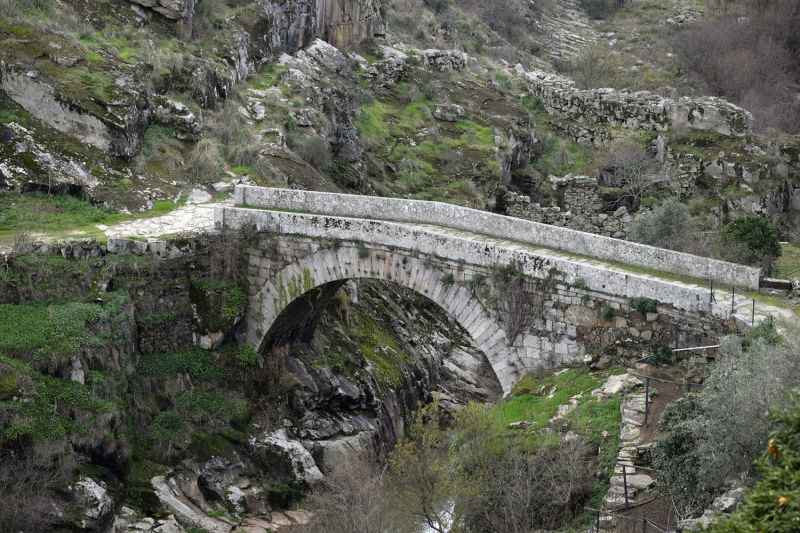
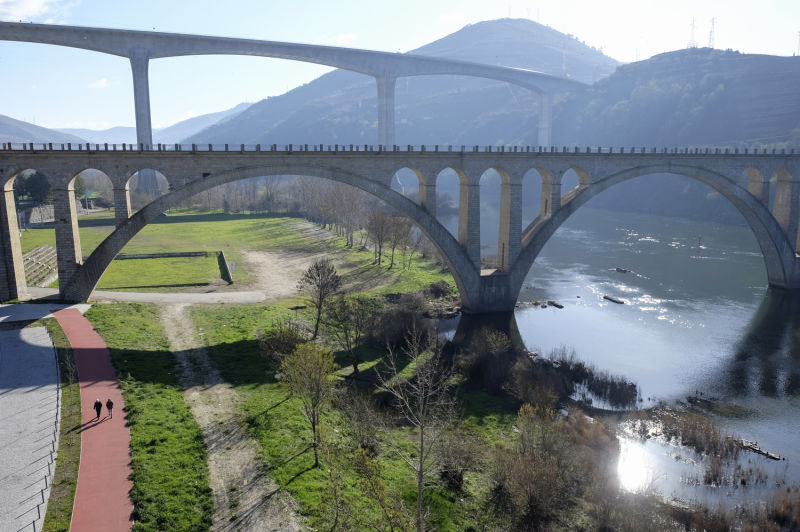
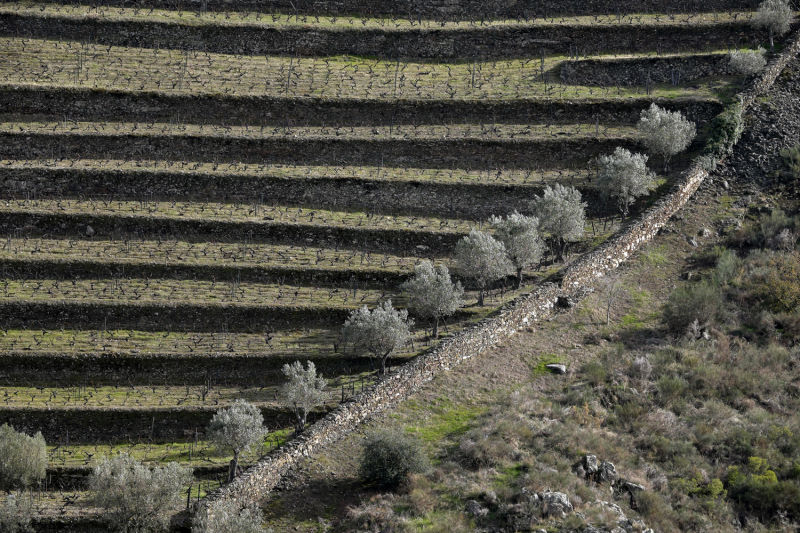
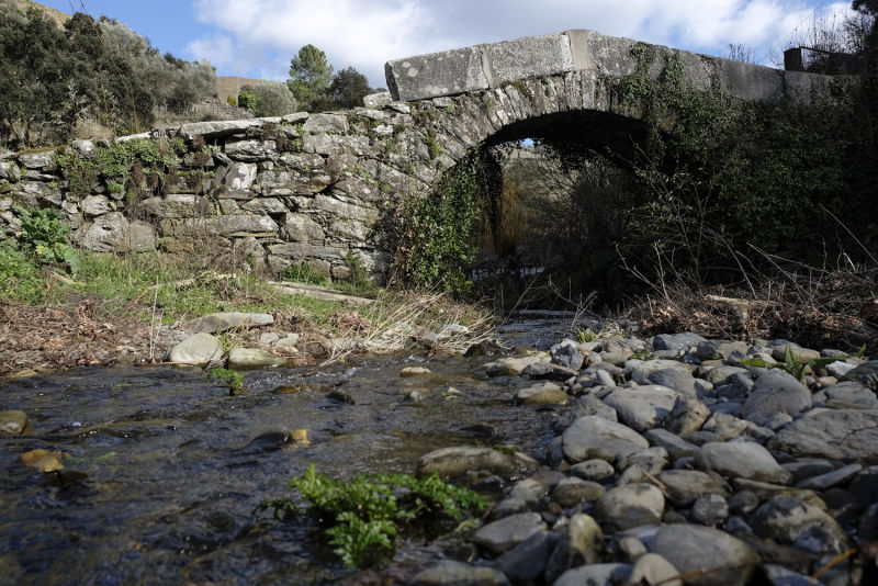
The walk between Lamego and Peso da Régua is one to remember for many years. Between the terraces of the Douro vineyards and the steep furrow of the Varosa River, we go from Santiago de Sande to Valdigem over a medieval bridge and approach Peso da Régua at high altitude, between old wine-producing farms and Régua's quay in the horizon. Once you cross the Douro River, it is worth taking a stroll along the riverside area of the great river of the north and regaining strength for what is yet to come. 

Between Souto de Sergude and Fontelas, the climb is steep. In fact, you only climb 300 metres, up steep lanes and slippery pavements. When entering the municipality of Mesão Frio and travelling along the road to Nostim, the dominant feeling is one of total freedom: legs remain fixed to the ground, but the destination towards which we are going is above earthly things. This is a type of freedom provided only by The Way of Saint James. 

From Mártir onwards, the route is comfortable, always downhill until Mesão Frio, accompanied by the Douro River, a silent and close companion that guides us down there, and at which we gaze, every now and then, in amazement.

Alternative dispute resolutionPrivacy policyCookies policyTerms and conditions 2024 In case of dispute click here here.