Stage 21 Redondela - Pontevedra

Santiago de CompostelaPadrónCaldas de ReisPontevedraRedondelaTuiRubiãesPonte de LimaBragaGuimarãesFelgueirasAmaranteMesão FrioLamegoMoimenta da BeiraSernancelheTrancosoPinhelAlmeidaGallegos de ArgañanCiudad RodrigoAlba de YeltesSan MuñozRobliza de CojosSalamanca

Redondela

Pontevedra

20 Km Distance
Low Difficulty
4 Hours Duration
674 m Ameal 7,8 km 16,4 km 7,8 km SALAMANCA 805,3 m 882,8 m (altitudemáx.) Peñasolana 867 m 826 m El Encinar de la Rad 837 m (altitudemáx.) 6,5 km 4,1 km 8,4 km 819,3 m ROBLIZA DE COJOS 810 m Ermida de Santiago 819 m Estrada CV-107 12,4 km 9,6 km 4 km 839 m (altitudemáx.) 797 m Rio Yeltes 821 m Ribeira de Cabrillas SAN MUÑOZ 778 m 844 m (altitude máx.) 10,6 km 7,1 km 8,3 km 771 m Bocacara 727 m Pedro Toro ALBA DE YELTES 784,4 m 689 m (altitudemáx.) 12,4 km 3,6 km 621,5 m CIUDAD RODRIGO 596 m Ponte de Marialba 8,3 km 12,4 km 5,3 km 758,5 m (altitude máx.) Vale da Mula 689 m Aldea del Obispo 718 m Alameda de Gordón 663,3 m GALLEGOS DE ARGAÑAN 12,6 km 5,2 km 3,5 km 540 m Ponte do Rio Côa 739 m ALMEIDA 685 m Valverde 8,8 km 6,7 km 7,4 km 7,8 km 557 m Póvoa del Rei 633,6 m PINHEL 584 m Valbom 605 m Ponte do Abade 862 m TRANCOSO 6,4 km 9,1 km 11,9 km 650 m Benvende 3,5 km 9,5 km 3,8 km 2,7 km 592 m Arcozelo do Cabo 763 m SERNANCELHE 590 m Penso 564 m Vila da Ponte 839,9 m (altitude máx.) 14,6 km 10 km 5 km 451 m Ucanha 759 m Sarzedo 696,8 m MOIMENTA DA BEIRA 9,3 km 6,3 km 5,3 km 6,9 km 387 m Nostim Peso da Régua 529,5 m LAMEGO 258 m Valdigem 883,5 m (altitude máx.) 13,2 km 6 km 8,4 km 157 m Ovelhinha 316,7 m MESÃO FRIO 779 m Padrões 412,4 m (altitude máx.) 8,5 km 7 km 5 km 336 m Caramos 264 m Telões 95,9 m AMARANTE 425,2 m (altitude máx.) 12 km 5,8 km 315,7 m FELGUEIRAS 156 m Arco de Pombeiro 8,9 km 4 km 7,8 km 236 m Fraião 128 m Caldas das Taipas 194,5 m GUIMARÃES 436,7 m (altitude máx.) Falperra Vila de Prado 17 m Penegate 127 m Anais 238 m 274,8 m (altitude máx.) 7 km 12,1 km 8,7 km 7,6 km 190,5 m BRAGA 400,4 m (altitude máx.) 10 km 6 km 2,9 km 30 m Arcozelo Alto da Labruja 2,3 m PONTE DE LIMA 230,9 m (altitude máx.) 11 km 5,7 km 6,1 km 9,7 km 18 m Cruz de São Telmo 31 m O Porriño 83 m Mós 50,8 m TUI 275,3 m (altitude máx.) 11,2 km 2,6 km 4,7 km 34 m Valença 172 m Gontomil 200,7 m RUBIÃES 128,1 m (altitude máx.) 16 km 4,9 km 30 m Briallos 10,1 m PONTEVEDRA 153,3 m (altitude máx.) 5 km 7 km 8 km 31 m O Pobo 5 m Pontesampaio 13,5 m REDONDELA 164,9 m (altitudemáx.) 6,3 km 6,7 km 5,7 km 60 m São Miguel de Valga 147 m Carracedo 24,8 m CALDAS D’EL REIS 12,7 km 5,2 km 6,2 km 40 m A Escravitude 103 m Francos 265,7 m 9,9 m PADRÓN SANTIAGO DE COMPOSTELA

Introduction

The oyster coast

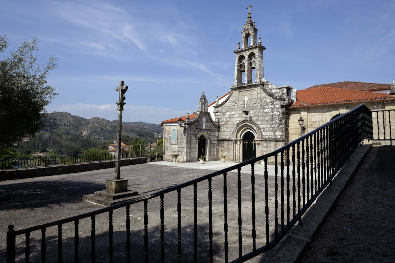
As far as Pontesampaio, the stage is stunning, with the Vigo lagoon always nearby. Be sure to observe the impressive clusters of granaries along the route. Between Cesantes and Tuimil, the EN 550 junction can be dangerous, as the roadsides are tarmacked, extending the lane. The small climb to the western side of Alto da Cabaleira is worth the descent, along dirt tracks with the maritime horizon of the lagoons accompanying us all the way. At Pontesampaio, famous for its oysters, it is time to rest, enjoying the harmony of the elements that come together there.

On the other side of the lagoon, the climb is short, through sections of a road of Roman origin, now made of old irregular slabs. Further ahead, despite the tarmacked sections, the forest surroundings reinforce the solitude and the nostalgia of the first stages, so many days ago.

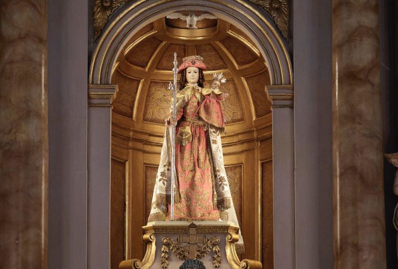
Pontevedra, a militantly Jacobean city, is just a few steps away. If you arrive early (if possible around 3 p.m.), you can rest for a while at the hostel and then set off to discover the historic centre, free of cars, where you will be amazed by the Chapel of the Pilgrim Virgin and many other spots of Pontevedra.

Alternative dispute resolutionPrivacy policyCookies policyTerms and conditions 2024 In case of dispute click here here.